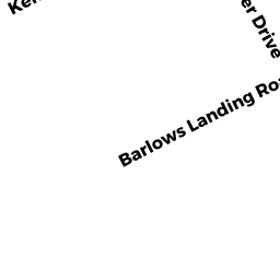
361 BARLOWS LANDING RD
Owner Information
KLEIN LYNNE A ETVIR
1665 SUMMIT AVE
NEW ALBANY, IN 47150


Property Details
361 BARLOWS LANDING RD is classified as a Two-Family Residential (Conventional).
The primary structure on this property was built in 1870. There are 1,852ft2 of built area within this property. There is 1,852ft2 of residential/living space within this property. This property is listed as having 8 rooms.
361 BARLOWS LANDING RD is valued at $289,900. The land is valued at $129,900 and the structures are valued at $151,800. There is an additional valuation of $8,200 on this property.
This property is in Zone 1. Confirm with local Zoning Board authorities to ensure there are no overlays or other easements on this property.
361 BARLOWS LANDING RD was last sold on Thursday, August 22, 2013 for $100,000.
Assessment data from fiscal year 2020.
Flood Data
This property is partially within the AE Zone (within floodplain). Approximately 0.0 acres (0.55%) of the property is within this zone.
The base flood elevation for this flood zone is 15 feet.
This information is sourced from the FEMA National Flood Hazard Layer. See our full disclamer.
Broadband Internet Providers
| Provider | Type | Bandwidth (mbps) | |
|---|---|---|---|
| Verizon New England Inc. | DSL | 7 | 0 |
| Viasat Inc | Satellite | 35 | 3 |
| HughesNet | Satellite | 25 | 3 |
| VSAT Systems, LLC. | Satellite | 2 | 1 |
| GCI Communication Corp. | Satellite | 0 | 0 |
| Comcast | Cable | 1000 | 35 |
Broadband service provider data from December 2020.